Philatelic Literature Specialists
-
General Philatelic
- Airmail
- Auction Catalogues
- Bibliographies
- Bilig Philatelic Handbooks
- Cinderellas
- Exhibitions & Congresses
- Forgeries
- Fred J Melville
- General Handbooks
- History of Philately
- Jean-Baptiste Moens
- Maritime
- Military
- Polar
- Postal History
- Postal Stationery
- Postmarks
- Railways
- Specimen Stamps
- The Royal Philatelic Society, London
- Thematics
- Vintage Catalogues
-
Great Britain
- Airmail
- Channel Islands
- Cinderellas
- Edward VII Issues
- Edward VIII Issues
- George V Issues
- George VI Issues
- Ireland
- Isle of Man
- Local Postal History
- London
- Maritime
- Military
- Perfins
- Post Office History
- Postal History
- Postal Stationery
- Postmarks
- Pre-adhesives
- QEII Issues
- Queen Victoria Issues
- Railways
- Scotland
- Telegraphs/Telephones
- Used Abroad
- Wales
-
British Commonwealth
- Aden
- Antigua
- Ascension
- Australia
- Bahamas
- Barbados
- Basutoland
- Batum
- Bechuanaland
- Bermuda
- Britis Central Africa
- British East Africa
- British Empire - General
- British Guiana
- British Honduras
- British North America
- British Occupied German Colonies
- British Occupied Italian Colonies
- British Solomon Islands
- British West Africa
- British West Indies
- Brunei
- Burma
- Cameroons
- Canada
- Cape of Good Hope
- Cayman Islands
- Ceylon
- Christmas Island
- Cocos (Keeling) Islands
- Cook Islands
- Cyprus
- Dominica
- Egypt
- Falkland Islands
- Fiji
- Gambia
- Ghana
- Gibraltar
- Gilbert & Ellice Islands
- Gold Coast
- Grenada
- Heligoland
- Hong Kong
- India
- Ionian Islands
- Iraq
- Jamaica
- Kenya
- Labuan
- Lagos
- Leeward Islands
- Levant
- Long Island
- Madagascar
- Mafia
- Malaya
- Malta
- Mauritius
- Montserrat
- Morocco Agencies
- Natal
- Nauru
- Nevis
- New Hebrides
- New Republic
- New Zealand
- Niger Coast
- Nigeria
- Norfolk Island
- Noth Borneo
- Nyasaland
- Orange Free State
- Pakistan
- Palestine
- Papua
- Pitcairn
- Rhodesia
- Saint Vincent
- Samoa
- Sarawak
- Seychelles
- Sierra Leone
- Somaliland
- South Africa
- South West Africa
- St. Christopher
- St. Helena
- St. Kitts
- St. Lucia
- Straits Settlements
- Sudan
- Swaziland
- Tanganyika
- Togo
- Tokelau
- Tonga
- Transvaal
- Trinidad & Tobago
- Tristan da Cunha
- Turks & Caicos Islands
- Uganda
- Vanuatu
- Virgin Islands
- Zanzibar
- Zululand
-
Europe & Colonies
- Aaland Islands
- Albania
- Andorra
- Armenia
- Austria
- Azerbaijan
- Belgian Congo
- Belgium
- Bosnia
- Bulgaria
- Crete
- Croatia
- Cyprus
- Czechoslovakia
- Danish West Indies
- Danzig
- Denmark
- Estonia
- Europe - General
- Finland
- France
- French Colonies
- German Colonies
- Germany
- Gibraltar
- Greece
- Greenland
- Heligoland
- Hungary
- Iceland
- Ionian Islands
- Ireland
- Italy
- Latvia
- Liechtenstein
- Lithuania
- Luxembourg
- Malta
- Memel
- Moldavia
- Monaco
- Montenegro
- Netherlands
- Norway
- Poland
- Portugal
- Roumania
- Russia
- San Marino
- Serbia
- Slovakia
- Slovenia
- Spain
- Sweden
- Switzerland
- Thurn & Taxis
- Turkey
- Ukraine
- Upper Silesia
- Vatican
- Yugoslavia
- The Americas
-
Africa
- Abyssinia
- Algeria
- Angola
- Basutoland
- Bechuanaland
- Belgian Congo
- British East Africa
- Cameroons
- Cape of Good Hope
- Egypt
- Ethiopia
- French Equatorial Africa
- Gambia
- German East Africa
- Ghana
- Gold Coast
- Kenya
- Lado Enclave
- Lagos
- Liberia
- Libya
- Madagascar
- Mafia
- Mauritius
- Morocco
- Mozambique
- Natal
- New Republic
- Niger Coast
- Nigeria
- Nyasaland
- Orange Free State
- Rhodesia
- Seychelles
- Sierra Leone
- Somaliland
- South Africa
- South West Africa
- Sudan
- Tanganyika
- Togo
- Transvaal
- Tunisia
- Uganda
- Zambia
- Zanzibar
- Zululand
- Asia
- Middle East & Levant
- Journals
- Non-philatelic
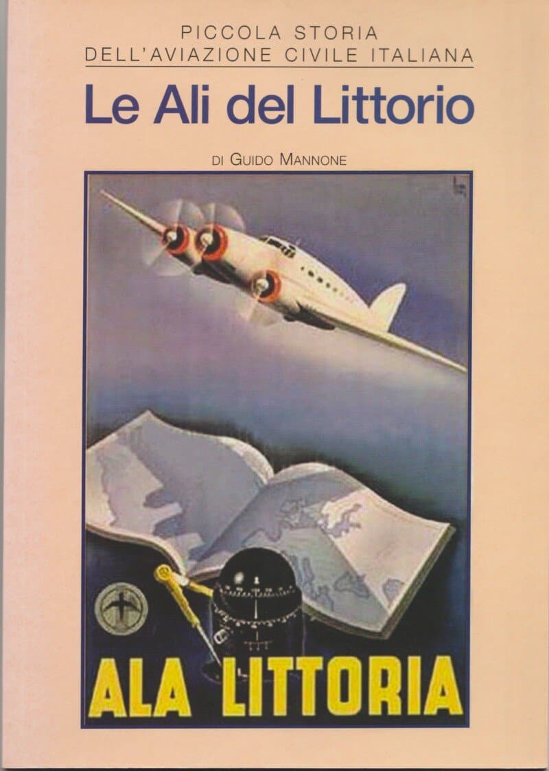
“Le Ali del Littorio” has been added to your basket. View basket
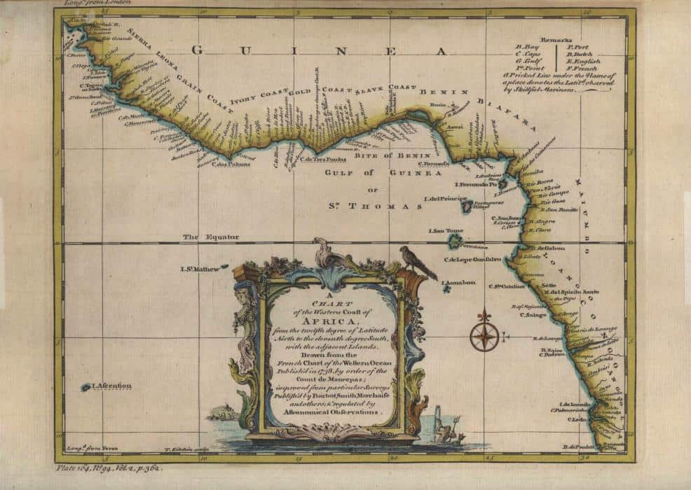
A Chart of the Western Coast of Africa, from the twelfth degree of Latitude North to the eleventh degree South, with the adjacent Islands. Drawn from the French Chart of the Western Ocean published in 1738, by order of the Count de Maurepas
Publisher: Barbot, Smith & Marchaise, nd [circa 1750s]
9¾” x 7¾”, hand coloured, upper border cropped a little tight, surface rubbed in a tiny spot at top left corner, in Good condition.
Rare early hand coloured map of West Africa.
£30.00
Related Products
![]()
© 2025, HH Sales.
Website by Paper Street.